


Artist / Author / Cartographer:
Mannevillette, Jean Baptiste N. D. Apres de
Title:
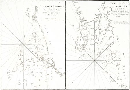
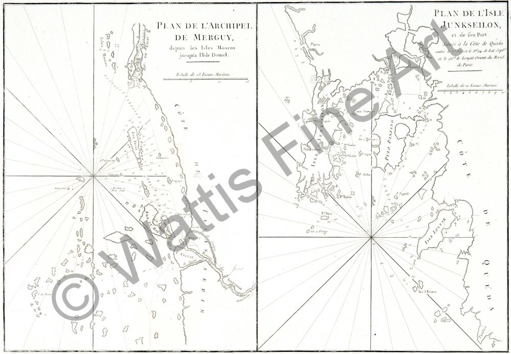
Phuket-Plan de L'Archipel de Merguy et L'Isle Junkseilon
Date:
c. 1775
Medium:
copper engraving
Size:
33.5 x 48.5 cm
Description:
Phuket and Merguy - Plan de L'Archipel de Merguy et L'Isle Junkseilon.
Two charts on one sheet. The first is Plan de L'Archipel de Merguy. Plan of the southwest coast of Burma showing the Mergui Archipelago.
The second is Plan de L'Isle Junkseilon. Plan of the island of Junkseilon or Phuket. One of the earliest European maps to show Phuket on the south west coast of Thailand in detail.
These maps were published for a French pilot atlas as an aid to navigation in the second half of the eighteenth century.
References:
Item Code:
MA4921
attachment:
