


Artist / Author / Cartographer:
Title:
Date:
Medium:
Size:
Description:
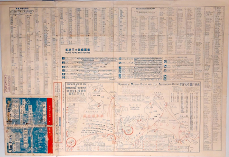
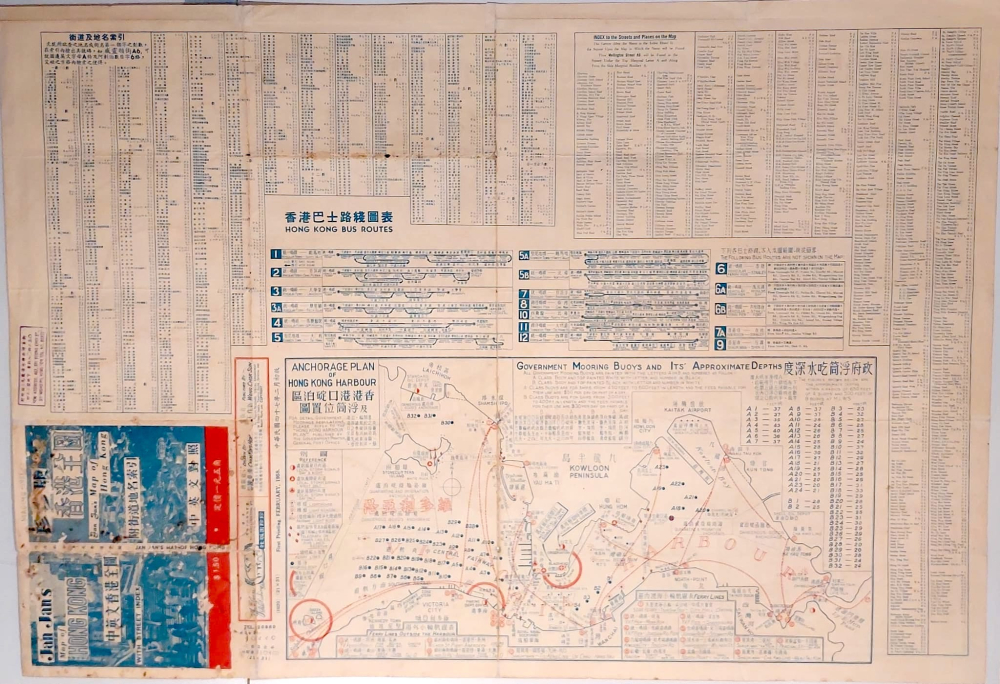
Drawn by Chan King Hon. Published by Wong Chok Sun. Jan Jan Publishing Co. Printed by Kam Shing Hing Kee Printing Co., 64, Wellington Street, Hong Kong.
Hal Empson states, "This is another remarkable private publication, and probably the first such street guide ever produced in Hong Kong. It obiously relies on government maps for basic data, a great deal of which has been crowded into a double-sided folded map. Though it may not be an example of good design, the map is certainly functional and is a fount of information.
Verso - The reverse side contains index to the street names, anchorage plan of Hong Kong Harbour, Government Mooring Buoys and its approximate depths, Ferry Lines and Hong Kong bus routes. At least two editions of this map have been identifiied and Jan Jan produced another version in 1961 entitled "A concise map of Hong Kong and the New Territories" which showed Hong Kong Island on one side and the whole territory on the other." Interestingly the Old Peak Road is still the Peak Road. Stubbs Road goes all the way up to the Peak tram station and a large section of it is still to be renamed Peak Road as it is today."
Empson, Hal Mapping of Hong Kong 1992. Pages 238 & 239.
Condition
Some minor damage and wear. But an unusual survival for a well used city plan.
References:
Item Code:
attachment:
