


Artist / Author / Cartographer:
Title:
Date:
Medium:
Size:
Description:
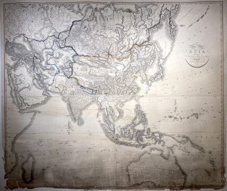
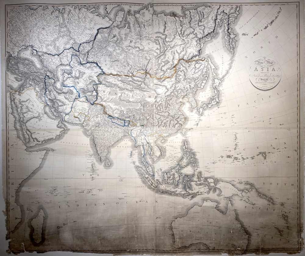
A New Map of Asia exhibiting its Natural and Political Divisions delineated from the Most Recent Authorities.
London: Printed for John Cary, No. 86 St. James Str. 1834.
A magnificent wall chart of Asia and Australia (New Holland). Singapore appears below Johor on the tip of the Malay Peninsula. The "Chinese Wall" is also shown to the north of China, as are various Dutch discoveries in Western Australia.
A rare wall chart by John Cary.
John Cary was an English cartographer, engraver, globe maker and publisher. He had premises firstly in the Strand and then in St. James’s Street, London. In 1794 he was the surveyor of roads to the General Post Office.
He was regarded as one of the finest English cartographers. He started working at a time when the large scale English County maps had recently become available, roads were being used as never before and accurate geographical information from distant countries was being received in ever increasing detail. His fine craftsmanship and ability as an engraver enabled him to make the fullest use of these sources and from them he produced a wide range of maps of great accuracy and clarity. His work covered not only county maps but world atlases, road maps, town and canal plans, sea charts and terrestrial and celestial globes.
References
National Library of Australia
Tooley’s Dictionary of Mapmakers Revised Edition A – D 1999
Antique Maps Moreland and Bannister 1993
Condition
A small amount of loss to the border line in the lower left hand corner. Some minor damage and staining in the lower part. The chart has been laid down on canvas to support and strengthen it. The condition is pretty good for a chart of this age. A rare survival from the first half of the nineteenth century.
References:
Item Code:
attachment:
