


Artist / Author / Cartographer:
Title:
Date:
Medium:
Size:
Description:
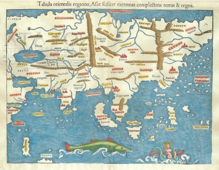
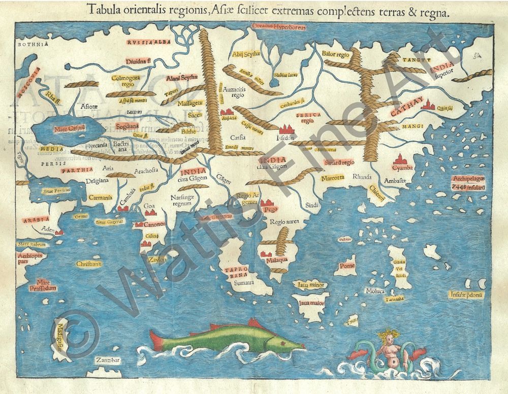
Tabula Orientalis Regionis, Asiae fecilicet etremas complectens terras & regna.
One of the earliest available engraved maps of the continent of Asia. An enormous fish appears in the Indian Ocean. A note in South East Asia states, Archipelagus 7448 Insularu. One wonders how Munster arrived at this figure? Latin text edition.
Sebastian Munster (1489 - 1552) was a professor of Hebrew at Basle University and an eminent hebraist, mathematician and geographer. He produced his own edition of Ptolemy's Geographia in 1540, adding a number of significantly new maps to the modern section of the work. There were further editions of the Geographia in 1541, 1542, 1545 and 1552. These were all printed at Basle with Latin text. His two major works the Geographia and the Cosmographia continued to be published by his step-son, Heinrich Petri, long after Muster's death of the plague in 1552. Later editions of Munster's Cosmographia included updated maps.
Munster was the first cartographer to devote a seperate map to each of the four continents. Sweet lists this as the second earliest available map of Asia.
Framed, with museum acrylic.
Reference
Sweet, Michael Mapping the Continent of Asia. Antiques of the Orient 1994. Illustrated back cover.
References:
Item Code:
attachment:
