


Artist / Author / Cartographer:
Title:
Date:
Medium:
Size:
Description:
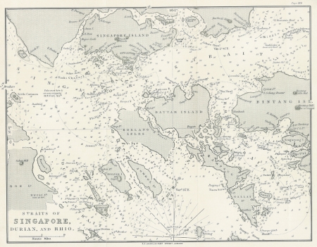
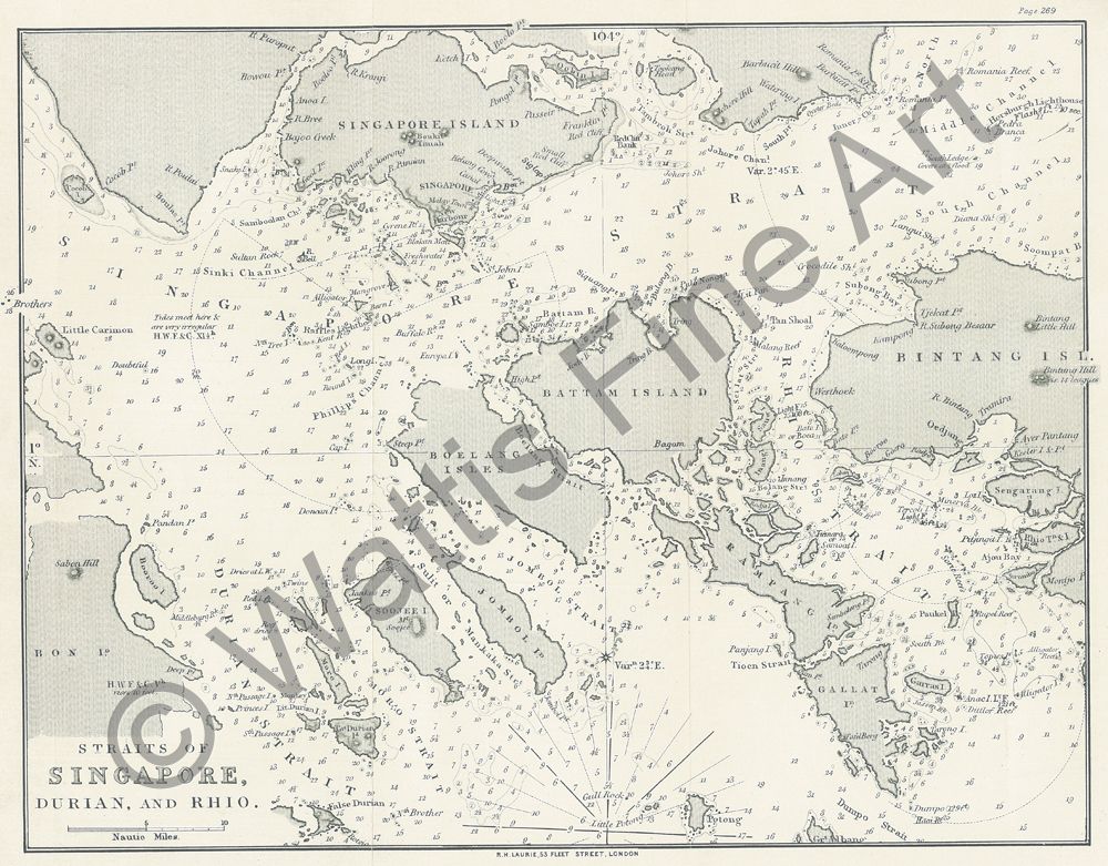
Straits of Singapore, Durian and Rhio. R.H. Laurie, 53, Fleet Street, London.
A detailed small orientation chart of the Straits of Singapore and nearby islands. The map was based on surveys made by the British Royal Navy. Details of some of the islands were provided by surveys made by the Dutch Royal Navy. There are a couple of notes about the 2 lighthouses in the Straits : 1. The Raffles Lighthouse on Coney Islet shows a bright fixed light, vis. 12 miles off, not visible from N.W.by W. northerly to E.S.E.. 2. The Horsburgh Lighthouse on Pedra Branca, is a granite tower, 97 feet high, and shows a brilliant revolving light, at an elevation of 95 feet above the sea; visible every min. at 15 miles off.
From "A Directory for the navigation of the Indian Archipelago, China and Japan". The Directory was a most useful publication and was an important guide along with the hydrographic maps produced by the Admiralty and blue back charts published at this time by James Imray. It was written by Alexander George Findlay FRGS and published by Richard Holmes Laurie in London.
References:
Item Code:
attachment:
