


Artist / Author / Cartographer:
Mannevillette, Jean Baptiste N. D. Apres de
Title:
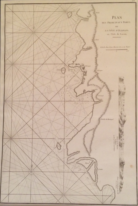
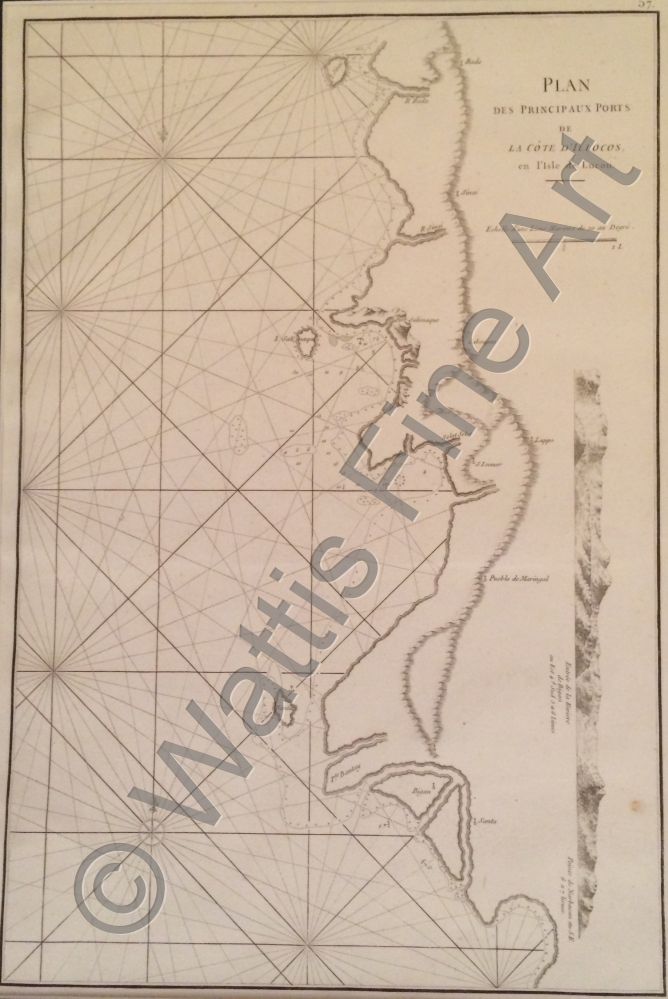
Philippines - Plan des Principaux Ports de la Cote D'Illocos
Date:
c1775
Medium:
copper engraving
Size:
48.5 x 32 cm
Description:
Plan des Principaux Ports de la Cote D'Illocos. An 18th century French hydrographic chart of the coastline of Ilocos, north west Luzon in the Philippine Islands.
References:
Item Code:
MA2020
attachment:
