


Artist / Author / Cartographer:
Title:
Date:
Medium:
Size:
Description:
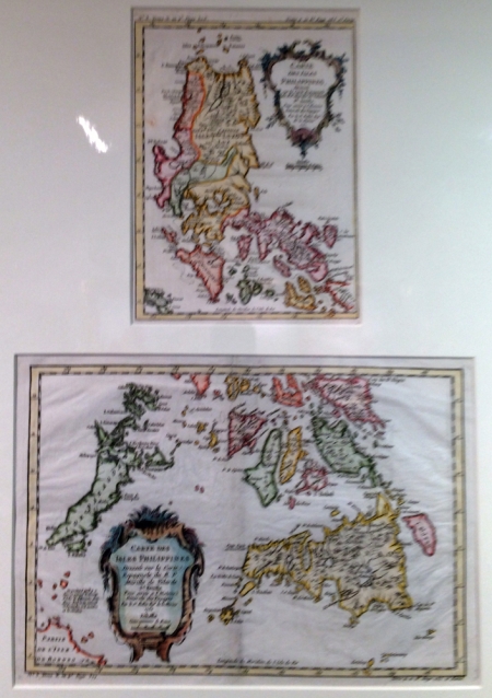
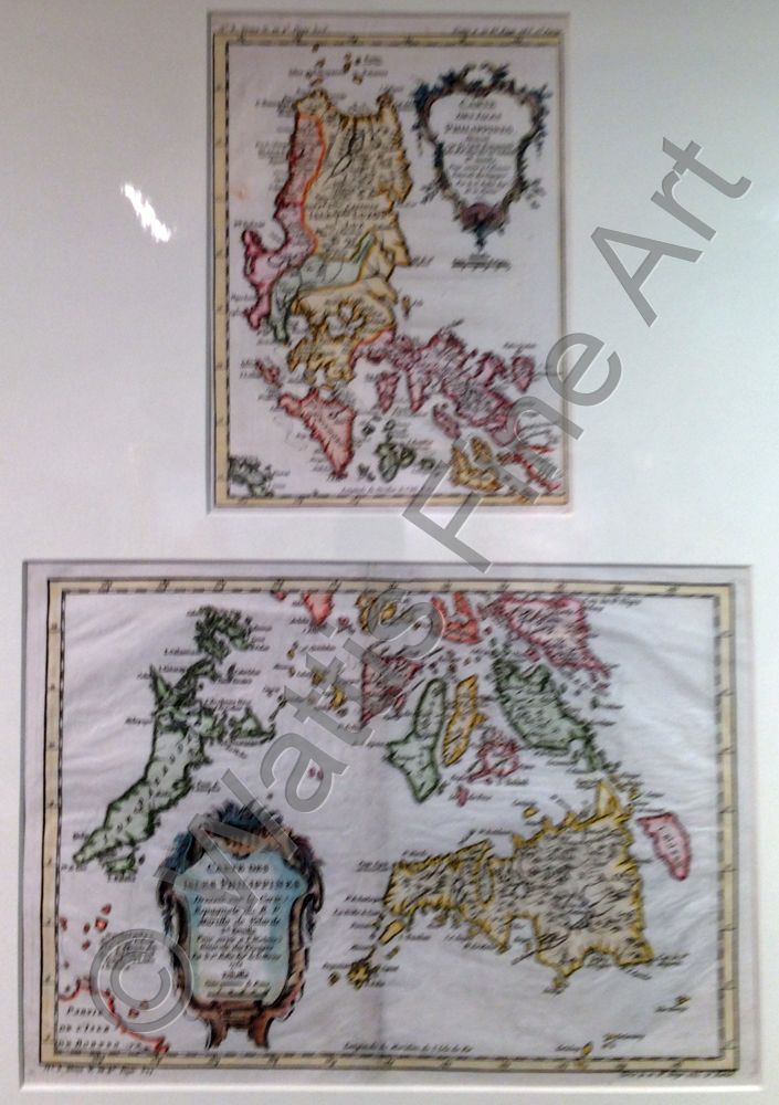
Carte des Isles Philippines dressee sur la carte Espagnole du R.P. Murillo de Velarde, 1re & 2e Feuille
Two maps of the Northern and Southern Philippine Islands mounted as one. They were produced by Nicolas Bellin after the original map by Father Murillo de Velarde of 1734. Pedro Murillo de Velarde was a Spanish jesuit priest, historian and cartographer. In 1734 in Manila he produced the most accurate map of the Philippines to date, Carta Hydrographia y Chorographia de las Islas Filipinas. The French cartographer Nicolas Bellin worked for over fifty years at the French Hydrographic Service where he was appointed the First Chief Hydrographic Engineer of the Depot des cartes, plans et journaux du Ministere de la Marine. While working there he was commissioned to carry out major surveys of all the known coasts of the world. This resulted in the production of a large number of sea charts of the highest quality which appeared in many editions with varying numbers of charts.
He was appointed Hydrographer to the King and was a member of the Royal Society in London. Among the books and atlases that contained Bellin’s maps of China and South East Asia were Abbe Prevost's Histoire Generale des Voyages 1746 and Le Neptune Francais 1753.
References:
Item Code:
attachment:
