


Artist / Author / Cartographer:
Title:
Date:
Medium:
Size:
Description:
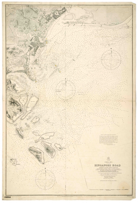
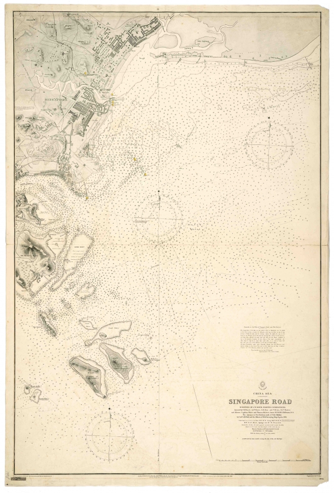
China Sea - Singapore Road Surveyed by J.W. Reed, Master Commanding Assisted by T.H. Tizard, Actg. Master, E.H.Bray and V.H.Lys, Secd. Masters and Messrs. Coghlan, White and Thomas, Masters Assts. R.N., HMS Rifleman, 1864. The entrance to New Harbour, north of Pulo Sikukur, by Comr. A.M.Field and the Officers of the Surveying Ship, Egeria, 1891. Soundings in fathoms.
Engraved by J & C Walker. Chart No. 1995.
First published at the Admiralty January 7th, 1865 under the superintendence of Captain G.H. Richards Royal Navy Hydrographer. The chart is based largely after the work of John William Reed and officers aboard the H.M.S. Rifleman in 1864. This, the result of the 4th major correction, is the edition of February 7, 1906. Sold by J.D. Potter Agent for the Admiralty, London.
Rare early engraved 1906 antique nautical chart of Singapore Road or anchorage surrounding the Singapore River.
References:
Item Code:
attachment:
