


Artist / Author / Cartographer:
Dutch East Indian Government Railway
Title:
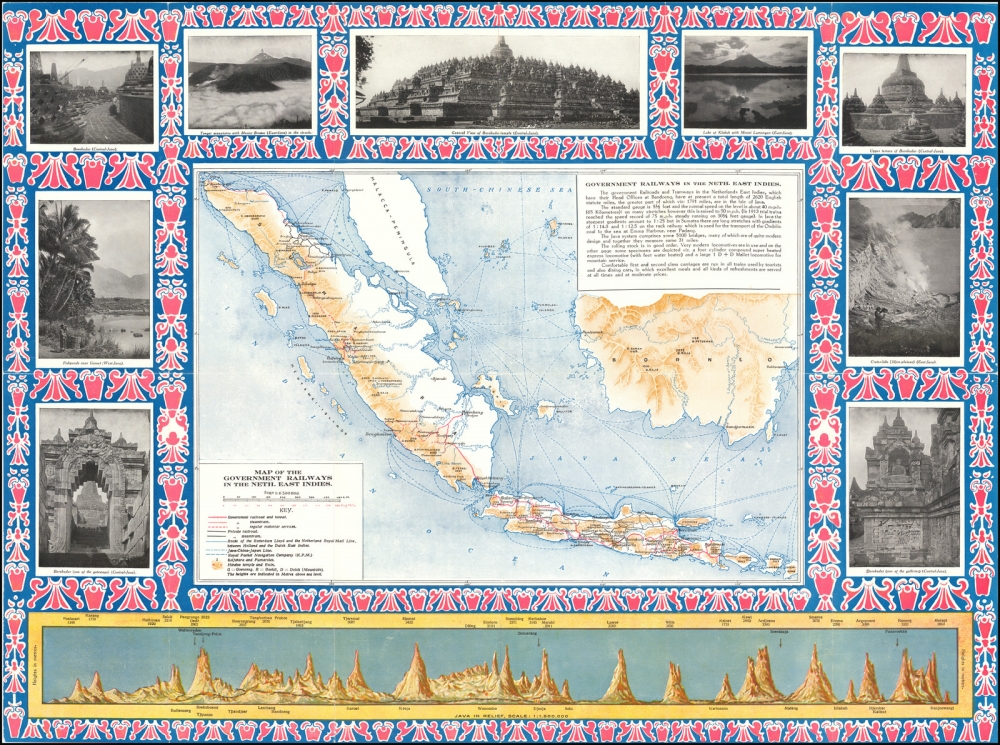
Map of the Government Railways of the Neth. East Indies.
Date:
c1925
Medium:
lithograph
Size:
18.5 x 24.5 inches
Description:
Map of the Government Railways of the Neth. East Indies.
Detailed map of the Dutch East Indies, focusing on the Railroad Maps and other transportation routes in and around the islands.
The map is ringed by photographs of points of interest in and around the islands, along with a profile view of the island of Java, focusing on the elevations of of the tallest mountains.
Railroad routes include:
- Route of the Rotterdam Lloyd and the Netherlands Mail Line
- Java-China-Japan Line
- Royal Packet Navigation Company
- Government Railroads and Tunnels
- Government steamtrams
- Government motorcar services
- Private railroads
- Private Steamtrams
- Hindu Temples and Ruins
References:
Item Code:
attachment:
