


Maps
Artist / Author / Cartographer:
Title:
Date:
Medium:
Size:
Description:
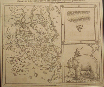
A sixteenth century wood engraved map of Sumatra and the Malay Peninsula. Malacca appears on the south west coast of the Peninsula and further down the coast the towns of Cingalilo and Cing. Further south the Straits of Sunda are shown and the tip of Java. The map is decorated with a splendid elephant being ridden by a mahout in a curious European mediaeval costume.
Sebastian Munster (1489 - 1552 was a professor of Hebrew at Basle University and an eminent hebraist, mathematician and ggeographer. He produced his own edition of Ptolemy's Geographia in 1540, adding a number of significantly new maps to the modern section of the work. There were further editions of the Geographia in 1541, 1542, 1545 and 1552. These were all printed at Basle with Latin text. His two major works the Geographia and the Cosmographia continued to be published in Basle by his step-son, Heinrich Petri, long after Munster's death of the plague in 1552. Updated maps ,some of which were based on the maps of Abraham Ortelius, were added to the Heinrich Petri editions from 1588.
References:
Item Code:
attachment:
