


Maps
Showing items 1 - 9 of 58
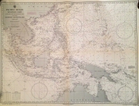
Pacific Ocean Western Part - Eastern Archipelago
U.S. Navy Hydrographic Office / 1944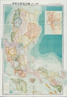
Philippines - Luzon
Japanese Mapmaker / 1943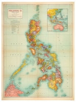
Philippine Islands - Philippine Is.
H.E.C. Robinson Pty. Ltd. / c1942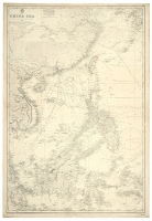
China Sea
Hydrographic Office of the Admiralty / 1887 (1937)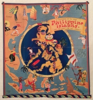
Philippine Islands - The Riviera of the Orient
Ruth Taylor White / c 1930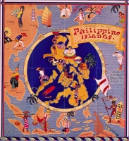
Philippine Islands - The Riviera of the Orient
Ruth Taylor White / c.1930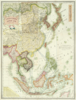
East Asia - Java China Japan Lyn Chart
Stanford, Edward / c1930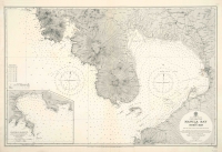
Manila Bay & Subic Bay
Hydrographic Office of the Admiralty / 1928
Philippine woman holding a conch shell
Hurtos, Juan / 1923
Showing items 1 - 9 of 58