


Maps
Artist / Author / Cartographer:
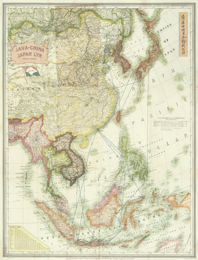
Stanford, Edward
Title:
East Asia - Java China Japan Lyn Chart
Date:
c1930
Medium:
lithograph, printed in colour
Size:
108 x 83 cm
Description:
Specially prepared by Edward Stanford, Ltd. Cartographers to H.M. The King. Stanford's Geographical Establishment, 12,13 & 14, Long Acre, London, W.C.2.
An attractive wall chart of East Asia published in London by Stanfords for the Dutch shipping line, "Java China Japan Lyn".
Map showing routes, ports of call and services of the Java.China.Japan Line. Regular passenger services from & to Java & Bali, Philippines & China. Through bookings to & from Japan, U.S.A. & Europe. JCJL.
There is a Java Road in North Point on Hong Kong Island which was named for the shipping line "Java China Japan Lyn" who had their headquarters there in the early 20th century.
MA8441
References:
Item Code:
MA8441
attachment:
