


Artist / Author / Cartographer:
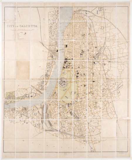
Burrard, Colonel S.G., R.E., F.R.S.
Title:
City of Calcutta
Date:
1911 (1919)
Medium:
heliozincograph
Size:
127.5 x 110 cm
Description:
Scale 6 inches = 1 mile.
Published under the direction of Colonel S.G. Burrard, R.E., F.R.S., Officiating Surveyor General of India. September 1911. Reprinted in 1919
Reg. No. 2619. D08-750
Engraved and heliozincographed at the Survey of India Office, Calcutta.
A 72 section canvas backed folding city plan of Calcutta published in Calcutta by the Survey of India Office in the early 20th century. A highly detailed city plan showing main roads, streets, railways, rivers, waterways and landmarks.
Condition
The canvas backing has been recently replaced and the map has been professionally conserved.
Exceedingly Rare.
References:
Item Code:
MA7058
attachment:
