


Artist / Author / Cartographer:
Title:
Date:
Medium:
Size:
Description:
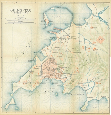
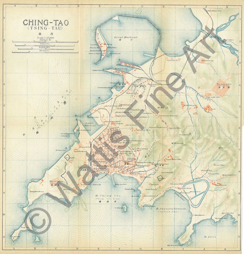
An early twentieth century map of Qingdao (the modern Pinyin Romanization). That map was published in the Japanese Imperial Railways guidebook series, An Official Guide to Eastern Asia, volume 4, covering China, published in 1915. The series began with volume 1 covering Manchuria and Chosen (Korea) in 1910. Volumes 3 & 4 covering Japan were published in 1914. After the First World War a fifth volume covering the East Indies (today's Malaysia and Indonesia. The guidebooks were indebted to the famous German Baedeker guides, but were innovative in their use of photographs. Voilume 4, redesignated volume D appeared in a revised edition as the Guide to China: with land and sea routes between the American and European continents in April 1924. The other volumes in the series were also revised, volume 1, adding Siberia, in the early 1920s and volumes 2 and 3, formatted as a single volume as An Official Guide to Japan in 1933.
References:
Item Code:
attachment:
