


Artist / Author / Cartographer:
Title:
Date:
Medium:
Size:
Description:
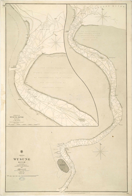
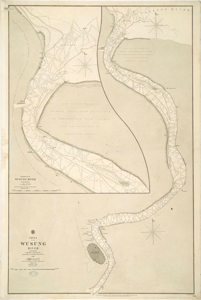
China - Wusung River Surveyed by Commander John Ward R.N. and the Officers of H.M. Ships Acteon and Dove 1858.
Engraved by J. & C. Walker. Chart no. 1601
A detailed hydrographic survey of the Wusung (Whangpoo) River. It was made by Captain John Ward R.N. and the Officers of H. M. Ships Acteon and Dove in 1858. It was engraved by J. and C. Walker and published by the Hydrographic Office of the Admiralty on 25th October 1859.
Details in Shanghai show the walled city, French ground, British ground and American ground. The consulates marked are French, Norwegian, Portuguese, British and American. Trinity church is indicated. The Entrance of the Wusung River is enlarged and shows forts on either side. On the west side Wusung village and a coal depot are marked. Notes on both sides of the river read, "Low level country highly cultivated protected by embankment from freshes and intersected by numerous canals".
Inset above is another map entitled, Entrance to Wusung River Enlarged.
References:
Item Code:
attachment:
