


Artist / Author / Cartographer:
Fries, Lorenz
Title:
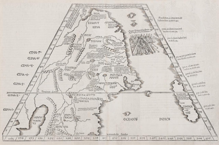
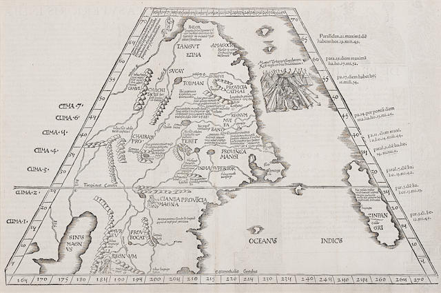
China - Tabula Superioris Indiae & Tartariae Maioris
Date:
after 1522
Medium:
woodblock
Size:
30.5 x 47.5 cm
Description:
Trapezoidal projection in Ptolemaic-format, embellished with woodcut of the king of Tartary.
The first western map to focus on China and Japan and the first map of this region to illustrate Marco Polo's writings in cartographic form.
Condition - Fold reinforced with some careful repair on verso, a good clean example.
Reference:
Walter Japan pl 3.
HKUST China in European Maps pl. 5.
The Robert and Alice Piccus Collection, Bonhams New York, October 21, 2020. Lot 63.
Mounted and framed, with Optium acrylic and with verso viewable.
References:
Item Code:
MA8216
attachment:
