


Artist / Author / Cartographer:
Chinese Mapmaker
Title:
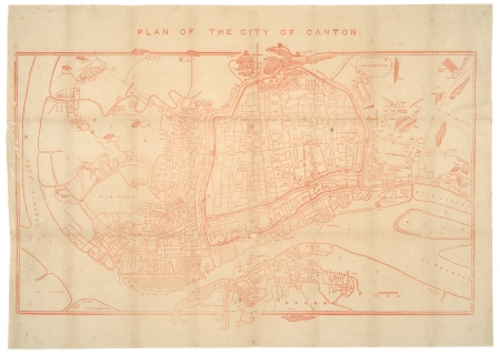
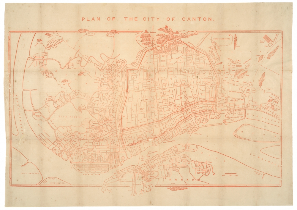
Plan of The City of Canton
Date:
1867
Medium:
woodblock printed in red
Size:
46.5 x 69 cm
Description:
An unusual 19th century city plan of Canton which was engraved on a woodblock by a Chinese mapmaker and printed in Hong Kong for a guide to the treaty ports.
The map was based on Chinese and Western sources, including the plan of Canton by the American missionary Daniel Vrooman from c1855.
Scarce.
Framed. Size with frame 68 x 90 cm
Condition
The original Chinese paper that was used for printing the map was quite fragile. This map has been professionaly restored and laid down on backing paper.
Reference
Mayers, W.F., Dennys N.B. and Chas. King The Treaty Ports of China and Japan 1867.
References:
Item Code:
MA8311
attachment:
