


Artist / Author / Cartographer:
Title:
Date:
Medium:
Size:
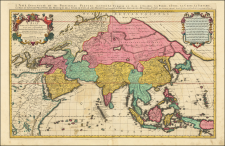
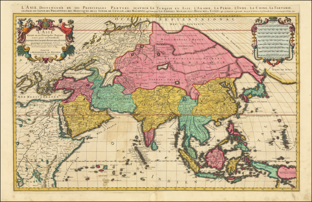
Description:
A magnificent map of Asia with beautiful original hand colour. The two-sheet map was originally published by Jaillot in 1692 based on the geography of Nicolas Sanson. Although the imprint line has not been updated, this example was probably published by Mortier in Amsterdam around 1696. This could explain this distinct bright colouring which is probably Dutch by origin.
The map extends as far east as New Guinea and "Terre Iesso" and west to Eastern Europe and the Nile River.
First issued in 1674, this two-sheet map of Asia provides a highly detailed picture of the continent, based upon the geographical compilations and work of Nicolas Sanson which remained unpublished at the time of his death.
Alexis-Hubert Jaillot (ca. 1632-1712) was one of the most important French cartographers of the seventeenth century. In 1664 he went into partnership with Nicholas Sanson's sons. Beginning in 1669, he re-engraved and often enlarged many of Sanson's maps, filling in the gap after the end of Blaeu's printing establishment in 1672.
MA82263
HK$ 37,000
References:
Item Code:
attachment:
