


Artist / Author / Cartographer:
Title:
Date:
Medium:
Size:
Description:
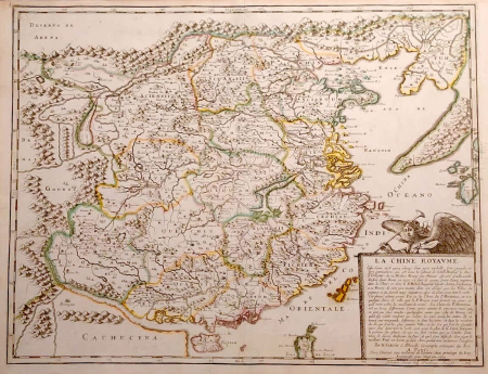
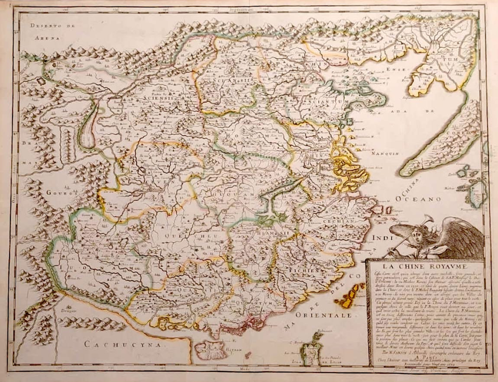
La Chine Royaume a Paris, chez L'Auteur aux Galleries du Louvre, avec privilege du Roy. Renouvelle pour vingt ans 1679
Although published in 1679 this map of China was based on a late sixteenth century projection by the Jesuit priest Michel Ruggiero.
Nicolas Sanson was born in Abbeville where as a young man he studied history, particularly of the ancient world, and it is said that he turned to cartography only as a means of illustrating his historical works. For this purpose he prepared a number of beautifully drawn maps, one of which, after he moved to Paris, came to the attention of Louis X111. In due course the King appointed him 'Geographe Ordinaire du Roi', one of his duties being to tutor the King in geography. In preparation of his major atlas, Cartes Generales de Toutes les Parties du Monde. After Sanson's death the business was carried on in Paris by his two surviving sons and grandson, in partnership with A. H. Jaillot. It is generally accepted that the great age of French cartography originated with the work of Nicolas Sanson but credit must go also to A. H. Jaillot and Pierre Duval for re-engraving his maps, many still unprinted at his death, and re-publishing them in face of strong competition from the Dutch, who continued to dominate the market until the end of the century. Sanson was interested in China and published at least four projections of the country and discussed their differeces in his atlases. This map includes an early outline of the Island of Formosa off the coast of China.
References:
Item Code:
attachment:
