


Artist / Author / Cartographer:
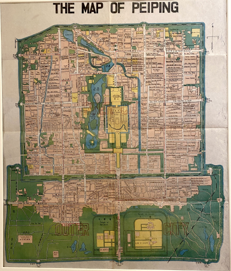
Science Press, Peiping
Title:
The Map of Peiping
Date:
c1938
Medium:
lithograph, printed in colour
Size:
43 x 36 cm
Description:
A city plan of Peking showing the major roads and buildings in the Inner City and the Outer City. Also depicted are the old walls and the relatively new railway lines. This map was probably published in Peking as a guide to tourists. Both Chinese and English characters appear on the map.
Maps of Peiping and its Environs in full colors. Published by Science Press, outside Ho Ping Men, Peiping. Distributed by Lynns Book Store, 128, Morrison St., Peiping.
References:
Item Code:
MA8113
attachment:
